Devon · PL19
Drone inspection services in Tavistock
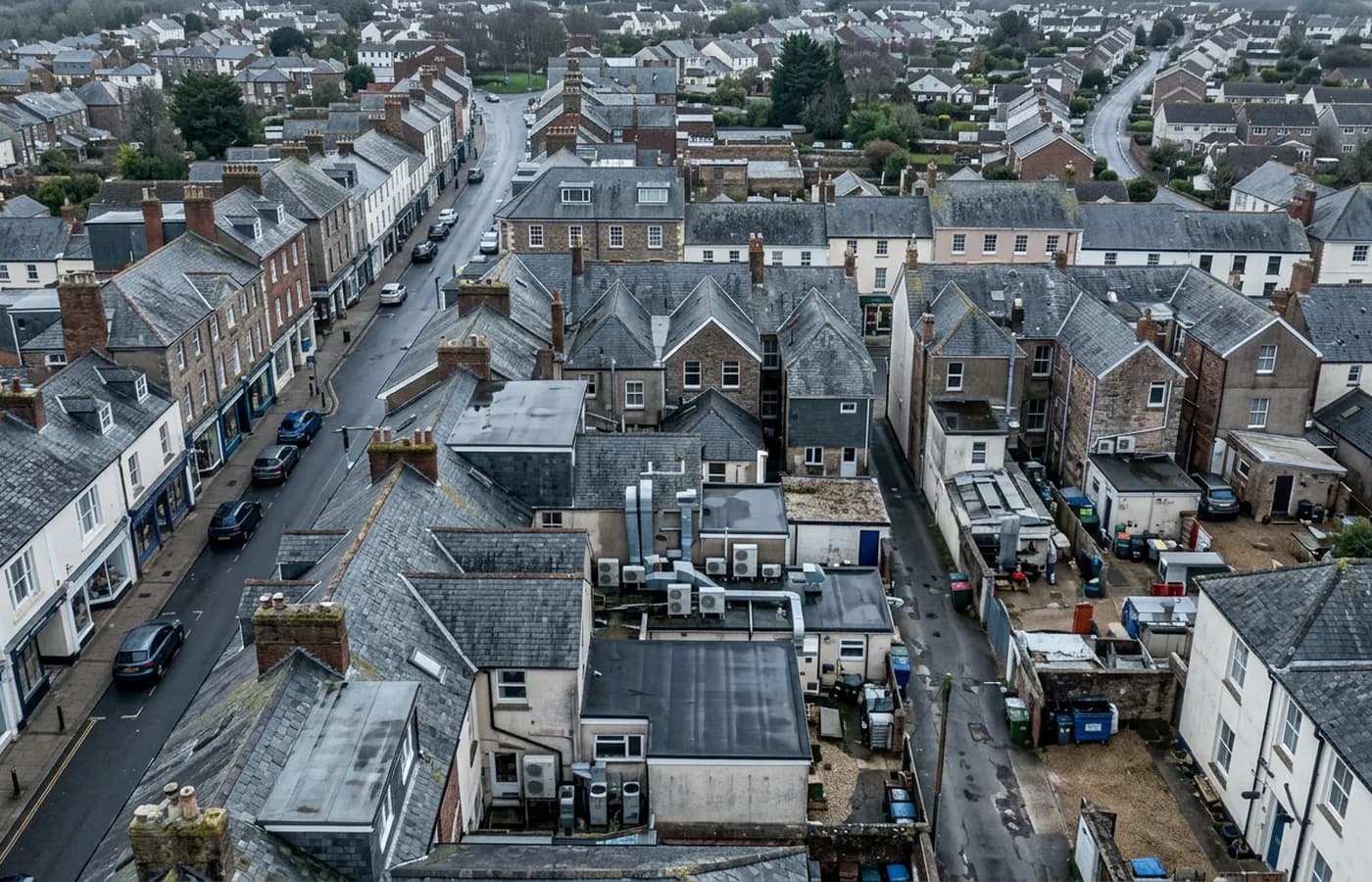
A stannary town of green Hurdwick stone with Crelake behind it: tall stone chimneys, steep sites and a very wet position on the moor edge.
Hurdwick stone and Victorian civic scale
The planned Victorian centre here was built on mining wealth and it is built properly: green Hurdwick stone, generous scale, tall stacks and slate roofs with stone-bedded ridges. Many of those buildings now carry commercial or mixed use, and their roofs are a different maintenance proposition to anything on a modern estate.
Stone-bedded ridges and slate on a building of that height fail slowly and expensively. A ridge that has lost its bedding lets water into the top course, the slate below loosens, and the process runs for years before anything shows internally. The stacks are the other concern: tall, exposed, and carrying flaunching and flashing details a long way above any safe standing position.
None of that is reachable without a scaffold or a substantial platform, and on a listed or historically sensitive building the access itself needs care. A camera reaches it without touching the building at all, which is often the only way an owner gets a look at their own ridge line.
Wet, and steeper than it looks
Dartmoor sits to the east and the prevailing south-westerly brings rain up the Tamar, so this is a very wet town. Steep sites are the multiplier: a building part way up a slope sits in higher wind loading than the roofline around it suggests, and tall stone chimneys on those sites carry real wind load.
For the trade and industrial stock at Crelake and Pixon Lane the pattern is the familiar one, with the wetness dialled up. Gutter silt stays saturated, corrosion runs at joints, and organic growth colonises anything shaded within a season or two.
The interval that makes sense here is closer to the Okehampton end of the range than the Yeovil end. Annual on anything exposed, and autumn rather than midwinter so the photographs are usable.
Mining landscape and heritage constraints
The town sits within the Cornwall and West Devon Mining World Heritage Site, and a proportion of the commercial building stock is historically designated in one form or another. That raises the cost of any physical intervention, including access equipment, and raises the value of a record that requires none.
Where a building is listed, an aerial photographic record is often the most detailed survey of its roof anybody has, and it is the thing a conservation-accredited surveyor or a specialist roofer will want to see before quoting.
The wider parish also carries a scatter of former mine buildings, engine houses and agricultural ranges in various states of repair, many of them now in commercial or holiday use. Buildings of that kind rarely have a maintenance history and often have no drawings at all, so the first useful document anybody produces for them is a set of photographs of what is actually there. For an owner planning works or a lender assessing security, that record does more work than a written description ever will.
Behind the inspection
What a Tavistock site is actually buying
CAA registered
A registered operator with an Operator ID and a Flyer ID held, which is the baseline any commercial client should be asking for and the first thing to check on a quote.
A2 Certificate of Competency
The A2 CofC, not a GVC. That decides how close the aircraft may legally be flown to people and property, so it decides what can be inspected and how, and it is set out plainly rather than buried.
Insured with Coverdrone
Commercial cover through Coverdrone. A certificate can be sent across for a site file or a contractor approval pack before the visit is booked.
Report within 48 hours
Photographs and a written report per asset within 48 hours of the flight, so the file is closed while the visit is still fresh in everyone's mind.
Nearby
Also covered around Tavistock
- OkehamptonThe wettest and windiest location on this list, at the foot of Dartmoor, with estate stock on the Exeter Road side and farms all around it.
- PlymouthA naval city where salt reaches well inland, with flat-roofed post-war blocks in the centre and heavy industrial stock at Cattedown and Estover.
- LauncestonA hilltop former county town with the Pennygillam and Newport estates on the A30 ground and slate hung buildings in the walled core.
- IvybridgeLee Mill and the A38 commercial ground sit at the southern moor edge, where gusting funnels down the Erme valley onto late twentieth century stock.
See how a visit runs
Request a site quote in Tavistock
Send the site address and the assets you want covered. Sam Hembury will come back with a fixed price, the paperwork, and the next slot the weather allows.